One other reason to walk down the narrow road back to the public parking area at Slieve League: During WWII, when all but Northern Ireland was neutral, the Irish government placed stone markers up and down the Donegal corridor. Stones, painted bright white, spelled out “Eire.” Meant to tell the pilots of allied aircraft flying from Enniskillen in Northern Ireland out over the Atlantic that they were in a free fly zone.
A few of the old markers are still around. And I’ve heard you can just make out the Eire sign near a viewing point at the bottom of the trail. So I walk. In the bitter cold (how can it be summer here?) and intermittent rain. Reeds and grasses swaying. Even the sheep have taken shelter, hiding in the deep grass.
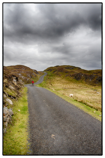
Halfway down the road I spot a speck of red coming towards me. The only thing of color in the otherwise heather-colored landscape. Lean against a cold rocky cliff and snap a pic. The black clouds, winding road, a sheep or two. And the red coat.
I nod as the red coat approaches. It’s a young man. “Sorry if I ruined your picture,” he says.
“No, I wanted you in it. The red coat and all.”
“Ah,” he says. We both continue walking.
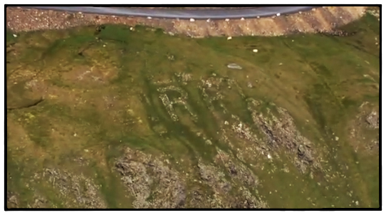
A little further on is a spot where you can look out over the hills and down the coastline. I stop and, using a telephoto lens, sweep the countryside looking for signs of the white stones. And there they are. Most gone, the few left overgrown by the marsh grasses. The first E is just a ghost but with a little imagination you can still make out the R and the E. EIRE. Ireland. A marker for the lonely boys, many of whom would not return, flying out over the stormy Atlantic.
Tags: Donegal, Ireland, Slieve League


Recent Comments